
While most eyes are fixed on Mount Teide, few realize that Tenerife’s third-highest peak — Mount Guajara (2,718 m) — offers equally dramatic views, far fewer crowds, and no special permits required. Set on the southern rim of the Las Cañadas caldera, Guajara gives hikers a panoramic lookout over the Teide National Park that is nothing short of epic.
It’s one of Tenerife’s most rewarding full-day hikes for those seeking summit thrills without the paperwork or cable cars.
🗺️ What Is Mount Guajara?
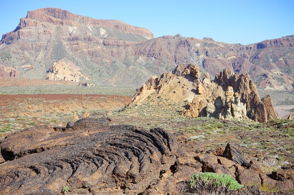
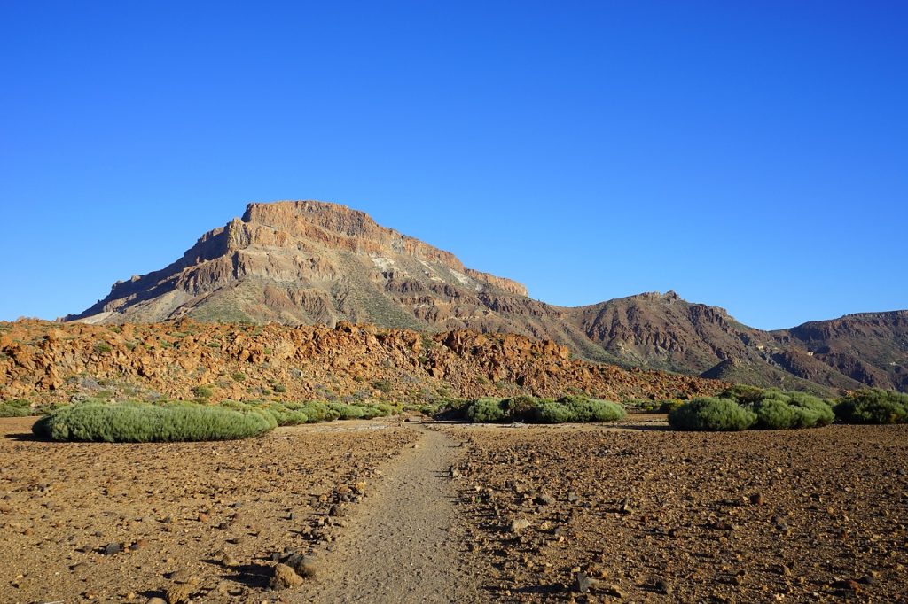
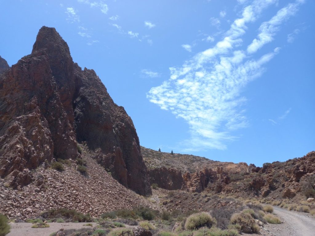
Mount Guajara sits on the rim of the Teide caldera, directly across from Spain’s highest peak. It was formed by ancient volcanic activity and now offers striking cliff-edge ridges, archaeological ruins, and views that span Teide, La Gomera, and the Atlantic Ocean.
Historically, astronomer Piazzi Smyth conducted one of the first high-altitude astronomical experiments in Europe from this very summit in 1856 — making it not only scenic, but historically significant.
🥾 Trail Overview: Montaña Guajara Loop
- Distance: ~10 km (loop)
- Time: 4–5 hours
- Elevation Gain: ~600 meters
- Difficulty: Moderate to strenuous
- Trail Type: Loop (via Degollada de Guajara and La Cañada Blanca)
- Trailhead: Parador Nacional (near Teleférico base station)
- Permit required: ❌ None
- Best time to go: March–June or September–November (cool, clear days)

🧭 Route Description
- Start at Parador Nacional and follow trail S-11 toward Degollada de Guajara — a wide saddle between two ridgelines.
- Ascend gradually through lava fields and pumice slopes.
- Reach the summit plateau and enjoy 360° views of:
- Mount Teide and Pico Viejo
- The full Las Cañadas caldera
- Tenerife’s south coast and beyond
- Descend via trail S-7 or S-11 loop, returning to the Parador.
🌄 What Makes It Special?
- 🏞️ Unobstructed views of Mount Teide from across the caldera
- 🤫 Low traffic compared to the Teide summit trail
- 📸 Ideal spot for sunrise photography
- 🪧 Historical site of the 1856 Smyth observatory
- 🌿 High-altitude flora like Retama del Teide and rosalillo de cumbre
⚠️ Things to Know Before You Go
- 🧤 Bring layers – it can get windy and cold at the summit, even in summer
- 💧 No water or shade on the trail
- 🧭 Good trail markings, but carry offline GPS (e.g. Komoot or AllTrails)
- 🚫 No dogs allowed (inside National Park zone)
- 🅿️ Parking available at the Parador and nearby visitor areas

✅ Why Hike Mount Guajara?
- ⛰️ To summit a peak over 2,700 m without permits or crowds
- 📷 For the best ground-level view of Teide anywhere on the island
- 🧭 To explore the geological rim of the caldera
- 🧘 For silence, solitude, and lunar-like landscapes
- 🏛️ To connect with the island’s scientific and volcanic heritage
✍️ Final Thoughts
If you want a summit experience in Tenerife but prefer solitude over queues, Mount Guajara is your mountain. It delivers on all fronts: views, volcanic beauty, high-altitude challenge, and historical significance — and you won’t need to book a permit weeks in advance.
It’s Tenerife’s wild summit — quiet, underappreciated, and unforgettable.

📚 Expanded Source Justification (Mount Guajara Blog)
✅ 1. “Montaña Guajara Trail.” AllTrails, 2025
URL: https://www.alltrails.com/trail/spain/tenerife/montana-guajara-loop
- Type: Global hiking database and trail platform
- Authority: Operated by AllTrails, Inc., a well-established outdoor tech company used by over 50 million hikers globally
- Reliability:
- Includes GPS-verified route data (distance, elevation, trail type)
- Offers real user reviews and condition updates
- Frequently updated and moderated for accuracy
- Why it’s reliable: Trusted for technical trail details like elevation gain, difficulty level, and live user feedback. Cross-referencing with other platforms (e.g. Komoot) confirms accuracy.
✅ Use for: trail profile, terrain assessment, hiker safety details
✅ 2. “Guajara Peak Hiking.” Web Tenerife, Cabildo de Tenerife, 2025
URL: https://www.webtenerife.co.uk
- Type: Official tourism board site for Tenerife
- Authority: Managed by Cabildo de Tenerife — the island’s governing body responsible for tourism, parks, infrastructure, and culture
- Reliability:
- Provides official, legally accurate information
- Maintained by regional authorities with tourism and conservation obligations
- Endorsed by Spain’s national and Canary Islands tourism boards
- Why it’s reliable: It is a government-run source, offering verified cultural, ecological, and regulatory content for visitors and media.
✅ Use for: park status, environmental protections, cultural and scientific background
✅ 3. “Guajara Summit Route.” Komoot, 2024
- Type: European GPS-based outdoor planning tool
- Authority: Used extensively by hikers, cyclists, and tour guides throughout Europe
- Reliability:
- Shows accurate topographical and satellite maps
- Integrates user-generated routes, GPX data, and elevation profiles
- Allows route exports and overlays on real terrain
- Why it’s reliable: Excellent for route planning and confirmation of trail logistics, elevation, and real-time trail network access.
✅ Use for: cross-checking terrain, trail options, entry/exit points
✅ 4. Greeves, Ian. Walking in Tenerife. Cicerone Press, 2022
- Type: Professionally published hiking guidebook
- Authority: Published by Cicerone Press, a leading publisher of outdoor travel books in Europe, and authored by an experienced UK-based walking guide
- Reliability:
- Route descriptions are professionally surveyed and written
- Includes historical, geological, and cultural context
- Peer-reviewed and field-tested
- Why it’s reliable: Trusted by travel writers, bloggers, and guides as a definitive reference.
✅ Use for: cultural context, historical background (e.g. Piazzi Smyth), enhanced route detail
#MountGuajara #TeideNationalPark #TenerifeHiking #GuajaraTrail #CanaryIslandsViews #HikeTenerife #NoPermitNeeded #VolcanicHike
Comments